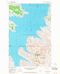
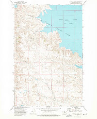
1958 Map of Sage Creek Point
USGS Topo · Published 1968About this map
Charles M Russell National Wildlife Range dominates this mid-century landscape where the waters of the Fort Peck Reservoir meet the intricate breaks of the Missouri River Basin. The topography is defined by prominent landforms such as Fourth Ridge and Fifth Ridge, which overlook the vast expanse of the reservoir. A historical cemetery is marked at Grave Point, suggesting a layer of early settlement life before the reservoir's normal pool elevation of 2246 feet reshaped the local geography. Recreational development is evident at The Pines Recreation Area, while the rugged drainage systems of North Embleton Coulee and South Embleton Coulee illustrate the complex erosion patterns of the Garfield and Valley County border. This map captures the transition of the Missouri River into a massive managed waterway, preserving the names of local landmarks like Chilkoot Pass and Bell Point within the protected wildlife range.
Find a feature on this map
22 named features on this map. Tap any name to fly to it.
Don’t see what you’re looking for? This feature index may not catch every label — zoom into the map to look around manually.
Map Details
Editions of this 1958 Sage Creek Point Map
2 editions found
Other maps of this area

1954 · Jordan
USGS Topo · 1:250,000

1956 · Jordan
USGS Topo · 1:250,000

1958 · Jordan
USGS Topo · 1:250,000

1958 · Lewis Reservoir
USGS Topo · 1:24,000

1958 · Sage Creek Point
USGS Topo · 1:24,000
1958 · Seventh Point Buttes
USGS Topo · 1:24,000
1958 · Skunk Coulee
USGS Topo · 1:24,000

1964 · Jordan
USGS Topo · 1:250,000
1972 · Gilbert Creek
USGS Topo · 1:24,000
1972 · Norville Creek
USGS Topo · 1:24,000