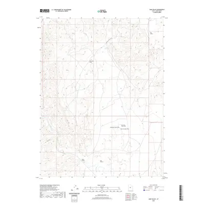
2020 Map of Sage Valley
USGS Topo · Published 2020About this map
Sevier River winds through the southern reaches of this landscape, cutting through Sevier Canyon as it flows westward. The topography is dominated by a complex system of drainage basins including Little Sage Valley and the broader Sage Valley, which branches into its East Fork, Middle Fork, and West Fork. This arid interior of Juab County is defined by its water management and transit routes, with W-Fork Reservoir providing a vital catchment point in the north. The presence of the Sage Valley Cut Off Rd and the Rocky Ford 1 trail indicates a landscape shaped by historical ranching and travel through the Great Basin’s high desert valleys, where Dog Valley sits tucked away in the northeastern corner.
Find a feature on this map
11 named features on this map. Tap any name to fly to it.
Don’t see what you’re looking for? This feature index may not catch every label — zoom into the map to look around manually.
Map Details
Editions of this 2020 Sage Valley Map
This is the sole edition of this map. No revisions or reprints were ever made.
Other maps of this area

1885 · Manti
USGS Topo · 1:250,000

1885 · Sevier Desert
USGS Topo · 1:250,000

1895 · Manti
USGS Topo · 1:250,000

1951 · Nephi
USGS Topo · 1:62,500

1952 · Scipio North
USGS Topo · 1:62,500

1953 · Delta
USGS Topo · 1:250,000

1956 · Price
USGS Topo · 1:250,000

1958 · Delta
USGS Topo · 1:250,000

1960 · Price
USGS Topo · 1:250,000

1962 · Price
USGS Topo · 1:250,000