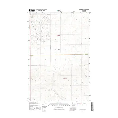
2017 Map of Sagebrush Flat
USGS Topo · Published 2017About this map
Sagebrush Flat dominates this high-plateau landscape along the border of Douglas Co and Grant Co. The terrain is characterized by a series of planned residential loops and spurs that cut through the shrub-steppe, bearing names that evoke a western frontier character. These developments, such as Rattler Loop, Settler Ln, and Whiffletree Way, follow a geometric grid typical of modern rural subdivision in the Columbia Basin. The network of roads, including Branding Iron Dr and Cornucopia Dr, illustrates the transition of this open space into a residential community. The topography is marked by subtle elevation changes and coulee-like features, showing the specialized land use patterns in this part of Washington during the early 21st century.
Find a feature on this map
60 named features on this map. Tap any name to fly to it.
Don’t see what you’re looking for? This feature index may not catch every label — zoom into the map to look around manually.
Map Details
Editions of this 2017 Sagebrush Flat Map
This is the sole edition of this map. No revisions or reprints were ever made.
Other maps of this area

1953 · Ritzville
USGS Topo · 1:250,000

1956 · Ephrata
USGS Topo · 1:62,500

1956 · Ephrata
USGS Topo · 1:24,000

1956 · Ephrata SW
USGS Topo · 1:24,000

1959 · Ritzville
USGS Topo · 1:250,000

1965 · Ritzville
USGS Topo · 1:250,000

1965 · Jameson Lake SW
USGS Topo · 1:24,000

1965 · Jameson Lake SE
USGS Topo · 1:24,000
1966 · Monument Hill
USGS Topo · 1:24,000
1966 · Rattlesnake Springs
USGS Topo · 1:24,000