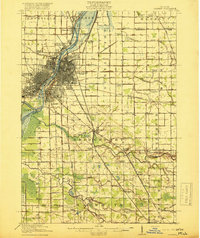
1919 Map of Saginaw
USGS Topo · Published 1919About this map
The Saginaw River serves as the industrial and logistical spine of this region during the early twentieth century, where the confluence of the Tittabawassee River, Shiawassee River, and Cass River creates a complex network of waterways and islands like Crow Island. The city of Saginaw and its western counterpart, Saginaw West Side, show a dense urban grid supported by the Michigan Central and Pere Marquette railroads.
Find a feature on this map
94 named features on this map. Tap any name to fly to it.
Don’t see what you’re looking for? This feature index may not catch every label — zoom into the map to look around manually.
Map Details
Editions of this 1919 Saginaw Map
3 editions found
Other maps of this area

1916 · Bay City
USGS Topo · 1:62,500

1917 · Chesaning
USGS Topo · 1:62,500

1917 · St. Charles
USGS Topo · 1:62,500

1919 · Bay City
USGS Topo · 1:62,500

1919 · Saginaw
USGS Topo · 1:62,500

1919 · Burt
USGS Topo · 1:62,500

1920 · Flint
USGS Topo · 1:62,500

1921 · Burt
USGS Topo · 1:62,500

1922 · Flint
USGS Topo · 1:62,500

1941 · Saginaw
USGS Topo · 1:62,500