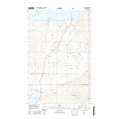
2013 Map of Sagle
USGS Topo · Published 2013About this map
Lake Pend Oreille dominates the northern landscape, where the Sandpoint Fish Hatchery and Springy Point overlook Murphy Bay. This region of Bonner County shows a distinct transition from the shoreline developments near Dover to the timbered heights of the Kanisku National Forest in the south. The central corridor is defined by a string of historic railroad and crossroads settlements including Lignite, Sagle, Algoma, Dufort, and Westmond. Local history is anchored by landmarks like the Sagle Community Hall and the Westmond Cem, while the rugged eastern terrain is marked by Bimetallic Ridge and Butler Mtn. Numerous small bodies of water, such as Shepherd Lake and Cocolalla Lake, are connected by a network of creeks like Fry Cr and Westmond Cr.
Find a feature on this map
95 named features on this map. Tap any name to fly to it.
Don’t see what you’re looking for? This feature index may not catch every label — zoom into the map to look around manually.
Map Details
Editions of this 2013 Sagle Map
This is the sole edition of this map. No revisions or reprints were ever made.
Other maps of this area

1901 · Sandpoint
USGS Topo · 1:125,000

1911 · Priest Lake
USGS Topo · 1:250,000

1911 · Sandpoint
USGS Topo · 1:125,000

1913 · Priest Lake
USGS Topo · 1:250,000

1949 · Packsaddle Mtn
USGS Topo · 1:62,500

1951 · Packsaddle Mtn
USGS Topo · 1:62,500

1951 · Elmira
USGS Topo · 1:62,500

1958 · Sandpoint
USGS Topo · 1:250,000

1963 · Sandpoint
USGS Topo · 1:250,000
1968 · Cocolalla
USGS Topo · 1:24,000