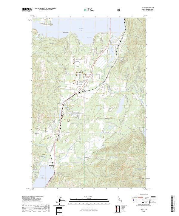
2024 Map of Sagle
USGS Topo · Published 2024About this map
The northern reaches of the Kaniksu National Forest overlook a landscape defined by the expansive Lake Pend Oreille and the smaller, southern Cocolalla Lake. This area of Bonner County centers on the community of Sagle and the surrounding timber and mountain terrain, including prominent heights like Butler Mtn and Bimetallic Ridge. The map details the transition from the high ridges down to the water's edge at Murphy Bay and Springy Point. A network of rural routes and family-named roads, such as Merril Martin Rd and Brisboys Rd, connects scattered settlements like Algoma, Dufort, and Westmond. Local history is anchored by sites like the Westmond Cem, while the drainage of Cocolalla Creek and Fry Creek illustrates the complex hydrology between the region's major lakes and the Pend Oreille River near Dover.
Find a feature on this map
111 named features on this map. Tap any name to fly to it.
Don’t see what you’re looking for? This feature index may not catch every label — zoom into the map to look around manually.
Map Details
Editions of this 2024 Sagle Map
This is the sole edition of this map. No revisions or reprints were ever made.
Other maps of this area

1901 · Sandpoint
USGS Topo · 1:125,000

1911 · Priest Lake
USGS Topo · 1:250,000

1911 · Sandpoint
USGS Topo · 1:125,000

1913 · Priest Lake
USGS Topo · 1:250,000

1949 · Packsaddle Mtn
USGS Topo · 1:62,500

1951 · Packsaddle Mtn
USGS Topo · 1:62,500

1951 · Elmira
USGS Topo · 1:62,500

1958 · Sandpoint
USGS Topo · 1:250,000

1963 · Sandpoint
USGS Topo · 1:250,000
1968 · Cocolalla
USGS Topo · 1:24,000