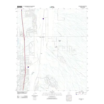
2012 Map of Sahuarita
USGS Topo · Published 2012About this map
Sahuarita and its surrounding residential developments sit in the Pima County desert as a testament to early 21st-century suburban expansion along the Interstate 19 corridor. The community is anchored by the Sahuarita Post Office and extends into neighborhoods like Sahuarita Heights and East Sahuarita. The arid landscape is defined by the ephemeral Santa Cruz River and the Box Canyon Wash, which cut through the terrain near the settlement of Duval. Significant transportation infrastructure is visible, including the Helmet Peak Interchange and the Duval Mine Road Interchange, highlighting the area's connection to regional mining and transit. Further south, features like Pear Tank reflect the traditional ranching water management necessary in this high-desert environment, while a dense network of local roads including W Williams Ranch Rd and S Santa Rita Rd serves the growing residential tracts.
Find a feature on this map
60 named features on this map. Tap any name to fly to it.
Don’t see what you’re looking for? This feature index may not catch every label — zoom into the map to look around manually.
Map Details
Editions of this 2012 Sahuarita Map
This is the sole edition of this map. No revisions or reprints were ever made.
Other maps of this area

1904 · Patagonia
USGS Topo · 1:125,000

1904 · Tucson
USGS Topo · 1:125,000

1905 · Patagonia
USGS Topo · 1:125,000

1905 · Tucson
USGS Topo · 1:125,000

1920 · Arivaca
USGS Topo · 1:125,000

1925 · Samaniego Peak
USGS Topo · 1:62,500

1925 · San Xavier
USGS Topo · 1:62,500

1926 · Helvetia
USGS Topo · 1:62,500

1934 · Tucson Mountains
USGS Topo · 1:125,000

1939 · Twin Buttes
USGS Topo · 1:62,500