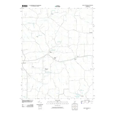
2010 Map of Saint Anthony
USGS Topo · Published 2010About this map
Saint Anthony and Saint Marks serve as central nodes in this pocket of Dubois County, where rural life is defined by a dense network of country roads and local water bodies. The settlement of Schnellville sits at the eastern edge of the quadrangle, connected to Kyana by a landscape carved by Flat Creek and Grassy Fork. This 2010 survey highlights the local importance of managed water resources, featuring many smaller reservoirs such as Birk Lake, Habig Lake, and the Saint Anthony Conservation Club Lake. In the south, the map reaches into the wooded margins of the Ferdinand State Forest Lake. Genealogists will find several notable burial sites including the Dungan Cemetery and Cox Cemetery, which are preserved alongside family-named landmarks like Larry Hopf Lake, reflecting the generational heritage of the southern Indiana countryside.
Find a feature on this map
59 named features on this map. Tap any name to fly to it.
Don’t see what you’re looking for? This feature index may not catch every label — zoom into the map to look around manually.
Map Details
Editions of this 2010 Saint Anthony Map
This is the sole edition of this map. No revisions or reprints were ever made.
Other maps of this area

1900 · St Meinrad
USGS Topo · 1:62,500

1903 · St. Meinrad
USGS Topo · 1:62,500

1946 · Jasper
USGS Topo · 1:24,000

1954 · Dubois
USGS Topo · 1:24,000

1954 · Huntingburg
USGS Topo · 1:24,000

1955 · Saint Anthony
USGS Topo · 1:24,000

1956 · Vincennes
USGS Topo · 1:250,000

1957 · Vincennes
USGS Topo · 1:250,000

1957 · Cuzco
USGS Topo · 1:24,000

1957 · Birdseye
USGS Topo · 1:24,000