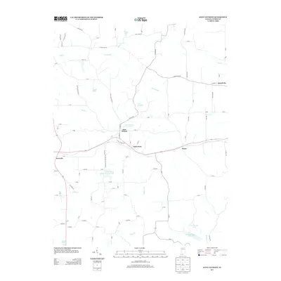
2013 Map of Saint Anthony
USGS Topo · Published 2013About this map
Saint Anthony and Saint Marks serve as the primary hubs in this corner of Dubois County, where the landscape is defined by a dense network of country roads and local water bodies. The community character is evident in the naming of local features like Saint Anthony School Lake and the Saint Anthony Conservation Club Lake, suggesting a strong local focus on shared recreational spaces. In the northeast, the settlement of Schnellville sits near the headwaters of the Grassy Fork and Hall Cr, while the southern reaches of the map include portions of the Ferdinand State Forest Lake. The drainage patterns of Flat Cr and Indian Cr carve through the terrain, connecting smaller hamlets like Kyana and Bretzville to the surrounding rural landscape of woods and water.
Find a feature on this map
90 named features on this map. Tap any name to fly to it.
Don’t see what you’re looking for? This feature index may not catch every label — zoom into the map to look around manually.
Map Details
Editions of this 2013 Saint Anthony Map
This is the sole edition of this map. No revisions or reprints were ever made.
Other maps of this area

1900 · St Meinrad
USGS Topo · 1:62,500

1903 · St. Meinrad
USGS Topo · 1:62,500

1946 · Jasper
USGS Topo · 1:24,000

1954 · Dubois
USGS Topo · 1:24,000

1954 · Huntingburg
USGS Topo · 1:24,000

1955 · Saint Anthony
USGS Topo · 1:24,000

1956 · Vincennes
USGS Topo · 1:250,000

1957 · Vincennes
USGS Topo · 1:250,000

1957 · Cuzco
USGS Topo · 1:24,000

1957 · Birdseye
USGS Topo · 1:24,000