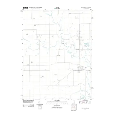
2011 Map of Saint Bernice
USGS Topo · Published 2011About this map
The borderlands of Indiana and Illinois unfold across this landscape, dominated by the winding path of Brouilletts Creek and its many tributaries. In this rural stretch of Edgar and Vermillion counties, the community of Saint Bernice serves as a primary hub, flanked by the smaller settlements of Jonestown and West Clinton. The area's agricultural and industrial heritage is quietly visible through features like the Shirkie Mine Pond and the clustered Horseshoe Lakes, which provide a distinct contrast to the grid-patterned fields of Clays Prairie.
Find a feature on this map
27 named features on this map. Tap any name to fly to it.
Don’t see what you’re looking for? This feature index may not catch every label — zoom into the map to look around manually.
Map Details
Editions of this 2011 Saint Bernice Map
This is the sole edition of this map. No revisions or reprints were ever made.
Other maps of this area

1947 · Ridge Farm
USGS Topo · 1:62,500

1947 · Paris
USGS Topo · 1:62,500

1949 · Paris
USGS Topo · 1:62,500

1950 · New Goshen
USGS Topo · 1:24,000

1950 · Sandford
USGS Topo · 1:24,000

1951 · Clinton
USGS Topo · 1:24,000

1951 · Saint Bernice
USGS Topo · 1:24,000

1953 · Indianapolis
USGS Topo · 1:250,000

1955 · Scottland
USGS Topo · 1:24,000

1955 · Dana
USGS Topo · 1:24,000