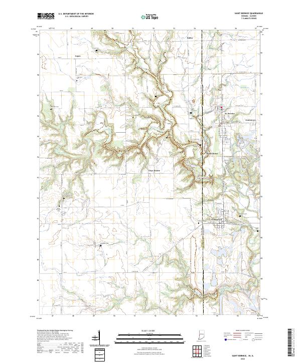
2022 Map of Saint Bernice
USGS Topo · Published 2022About this map
St. Bernice and Blanford anchor the eastern edge of this Vermillion County landscape along the Indiana-Illinois border. The terrain is defined by the winding course of Brouilletts Creek, which meanders through the central and southern portions of the quadrangle, joined by tributaries like Coal Cr. and Crabapple Creek. This modern survey reveals a dense concentration of family and community burial grounds, such as the Stafford Crimmons Cem and Saint Aloysius Cem, which offer significant genealogical data for researchers of the border region. The settlement pattern remains largely agricultural, with clusters of development at Jonestown and West Clinton, while the eastern boundary is further shaped by the Horseshoe Lakes near the state line. The map effectively traces the transition from the rolling drainage basins of the creek system to the organized grid of rural roads and small towns.
Find a feature on this map
68 named features on this map. Tap any name to fly to it.
Don’t see what you’re looking for? This feature index may not catch every label — zoom into the map to look around manually.
Map Details
Editions of this 2022 Saint Bernice Map
This is the sole edition of this map. No revisions or reprints were ever made.
Other maps of this area

1947 · Ridge Farm
USGS Topo · 1:62,500

1947 · Paris
USGS Topo · 1:62,500

1949 · Paris
USGS Topo · 1:62,500

1950 · New Goshen
USGS Topo · 1:24,000

1950 · Sandford
USGS Topo · 1:24,000

1951 · Clinton
USGS Topo · 1:24,000

1951 · Saint Bernice
USGS Topo · 1:24,000

1953 · Indianapolis
USGS Topo · 1:250,000

1955 · Scottland
USGS Topo · 1:24,000

1955 · Dana
USGS Topo · 1:24,000