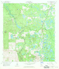
1958 Map of Saint Catherine
USGS Topo · Published 1970About this map
The Withlacoochee River carves a winding path through this corner of Central Florida, anchoring a landscape defined by expansive wetlands and early mid-century infrastructure. Small settlements like Saint Catherine and Croom are linked by the Coast Line and Seaboard Air Line railroads, reflecting the importance of rail transport for both passengers and the local extraction industry. Evidence of this industry is scattered across the sheet, including a phosphate pit and various quarries. Much of the area is protected within the Withlacoochee State Forest, where the terrain is punctuated by distinctive hydrological features such as Devils Slack Tub, McKenzie Lime Sink, and Wild Cow Prairie. Near the southern edge, the developing community of Ridge Manor sits adjacent to a golf course and a drive-in theater, signaling the post-war suburban shift in the Florida interior.
Find a feature on this map
54 named features on this map. Tap any name to fly to it.
Don’t see what you’re looking for? This feature index may not catch every label — zoom into the map to look around manually.
Map Details
Editions of this 1958 Saint Catherine Map
3 editions found
Other maps of this area

1954 · Spring Lake
USGS Topo · 1:24,000

1954 · Nobleton
USGS Topo · 1:24,000

1954 · Brooksville SE
USGS Topo · 1:24,000

1955 · Plant City
USGS Topo · 1:250,000

1958 · Plant City
USGS Topo · 1:250,000

1958 · Webster
USGS Topo · 1:24,000

1958 · Bushnell
USGS Topo · 1:24,000

1958 · Wahoo
USGS Topo · 1:24,000

1958 · Saint Catherine
USGS Topo · 1:24,000

1959 · Plant City
USGS Topo · 1:250,000