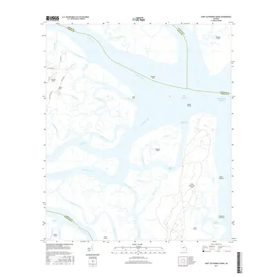
2017 Map of Saint Catherines Sound
USGS Topo · Published 2017About this map
Saint Catherines Island and Ossabaw Island dominate this coastal landscape where the Medway River and Bear River converge at Saint Catherines Sound. The map reveals a complex network of tidal waterways and marshy hammocks, including Walburg Island and the expansive Bull Town Swamp. On the mainland, small residential enclaves like Colonels Island are accessed by local routes such as Lake Pamona Dr and Deloach Rd, while Yellow Bluff provides an elevated vantage point over the salt marshes of Ashley Creek. This environment is shaped by the Intracoastal Waterway, which cuts through the sound behind the Middle Ground shoals. The transition from the North Newport River to the open Atlantic Ocean illustrates the shifting coastal topography of the Georgia Sea Islands, where features like Medway Spit and Cedar Point define the barrier island boundaries.
Find a feature on this map
49 named features on this map. Tap any name to fly to it.
Don’t see what you’re looking for? This feature index may not catch every label — zoom into the map to look around manually.
Map Details
Editions of this 2017 Saint Catherines Sound Map
This is the sole edition of this map. No revisions or reprints were ever made.
Other maps of this area

1920 · Sapelo River
USGS Topo · 1:62,500

1920 · Limerick
USGS Topo · 1:62,500

1928 · St Catherines Island
USGS Topo · 1:62,500

1943 · St Catherines Island
USGS Topo · 1:62,500

1943 · Sapelo River
USGS Topo · 1:62,500

1944 · Limerick
USGS Topo · 1:62,500

1944 · Ossabaw Island
USGS Topo · 1:62,500

1945 · St. Catherine's Island
USGS Topo · 1:62,500

1945 · Ossabaw Island
USGS Topo · 1:62,500

1945 · Sapelo River
USGS Topo · 1:62,500