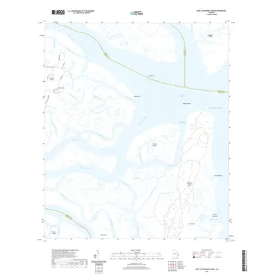
2020 Map of Saint Catherines Sound
USGS Topo · Published 2020About this map
Saint Catherines Island and Ossabaw Island anchor this coastal Georgia survey, where the intricate tidal marshes of the Sea Islands meet the Atlantic Ocean. The map documents a complex network of estuarine waterways, including the Medway River and North Newport River, which converge at Saint Catherines Sound. To the west, the settlements of Colonels Island and Yellow Bluff provide a human perspective on this maritime landscape, connected by a network of local roads like Youmans Rd and Deloach Rd.
Find a feature on this map
52 named features on this map. Tap any name to fly to it.
Don’t see what you’re looking for? This feature index may not catch every label — zoom into the map to look around manually.
Map Details
Editions of this 2020 Saint Catherines Sound Map
This is the sole edition of this map. No revisions or reprints were ever made.
Other maps of this area

1920 · Sapelo River
USGS Topo · 1:62,500

1920 · Limerick
USGS Topo · 1:62,500

1928 · St Catherines Island
USGS Topo · 1:62,500

1943 · St Catherines Island
USGS Topo · 1:62,500

1943 · Sapelo River
USGS Topo · 1:62,500

1944 · Limerick
USGS Topo · 1:62,500

1944 · Ossabaw Island
USGS Topo · 1:62,500

1945 · St. Catherine's Island
USGS Topo · 1:62,500

1945 · Ossabaw Island
USGS Topo · 1:62,500

1945 · Sapelo River
USGS Topo · 1:62,500