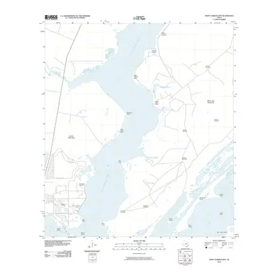
2010 Map of Saint Charles Bay
USGS Topo · Published 2010About this map
Lamar Peninsula and Black Jack Peninsula frame the coastal waters of Saint Charles Bay in this 21st-century mapping of Aransas County. The landscape is defined by its complex shoreline of inlets and bayous, including Big Devil Bayou and Bill Mott Bayou. Human presence is concentrated near the settlement at Lamar Cemetery and the Kalt Ranch Airport, while the wider coastal reach is dotted with functional landmarks like Saint Charles Windmill and Ratama Windmill.
Find a feature on this map
42 named features on this map. Tap any name to fly to it.
Don’t see what you’re looking for? This feature index may not catch every label — zoom into the map to look around manually.
Map Details
Editions of this 2010 Saint Charles Bay Map
This is the sole edition of this map. No revisions or reprints were ever made.
Other maps of this area

1952 · St. Charles Bay SW
USGS Topo · 1:24,000

1952 · St. Charles Bay
USGS Topo · 1:24,000

1952 · Mesquite Bay
USGS Topo · 1:24,000

1952 · Tivoli SE
USGS Topo · 1:24,000

1952 · Tivoli SW
USGS Topo · 1:24,000

1952 · St. Charles Bay SE
USGS Topo · 1:24,000

1953 · Beeville
USGS Topo · 1:250,000

1954 · Rockport
USGS Topo · 1:62,500

1954 · Vidaurri
USGS Topo · 1:62,500

1956 · Beeville
USGS Topo · 1:250,000