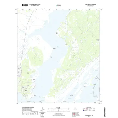
2019 Map of Saint Charles Bay
USGS Topo · Published 2019About this map
The community of Lamar sits at the southern tip of the Lamar Peninsula, where the waters of Saint Charles Bay meet Aransas Bay. This coastal landscape is defined by its complex network of points and bayous, including Meile Dietrich Point to the north and Bill Mott Bayou to the east. The map captures a transition between the established residential street grid of Lamar—featuring sites like Lamar Cem and the Kalt Ranch Airport—and the protected natural reaches of Goose Island. The Intracoastal Waterway cuts through the bay system, passing Bludworth Island and leading toward Carlos Bay. This area is a critical junction for maritime activity and ecological preservation along the Texas Gulf Coast, with numerous named geographical features like Egg Point and Dunham Point illustrating the intricate shoreline of the Aransas and Saint Charles basins.
Find a feature on this map
60 named features on this map. Tap any name to fly to it.
Don’t see what you’re looking for? This feature index may not catch every label — zoom into the map to look around manually.
Map Details
Editions of this 2019 Saint Charles Bay Map
This is the sole edition of this map. No revisions or reprints were ever made.
Other maps of this area

1952 · St. Charles Bay SW
USGS Topo · 1:24,000

1952 · St. Charles Bay
USGS Topo · 1:24,000

1952 · Mesquite Bay
USGS Topo · 1:24,000

1952 · Tivoli SE
USGS Topo · 1:24,000

1952 · Tivoli SW
USGS Topo · 1:24,000

1952 · St. Charles Bay SE
USGS Topo · 1:24,000

1953 · Beeville
USGS Topo · 1:250,000

1954 · Rockport
USGS Topo · 1:62,500

1954 · Vidaurri
USGS Topo · 1:62,500

1956 · Beeville
USGS Topo · 1:250,000