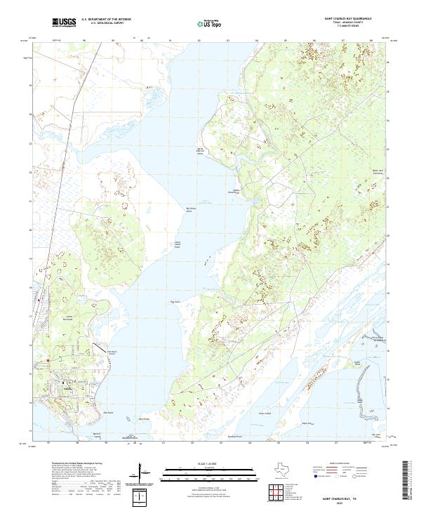
2022 Map of Saint Charles Bay
USGS Topo · Published 2022About this map
The Lamar Peninsula anchors this coastal survey, where the historic community of Lamar sits overlooking the confluence of Saint Charles Bay and Aransas Bay. This maritime landscape is defined by its complex shoreline, characterized by numerous points and bayous such as Melle Dietrich Point, Bill Mott Bayou, and Little Devil Bayou. The map illustrates the region's connection to the Intracoastal Waterway, which cuts through the southern reaches between Black Jack Peninsula and the northern tip of San Jose Island. For those researching local history or genealogy, the residential grid of Lamar is shown in detail, including the Lamar Cem and the Kalt Ranch Airport further inland. The survey captures a modern view of this environmentally sensitive area, documenting the Third Chain of Islands and various reefs that protect the inner bays.
Find a feature on this map
57 named features on this map. Tap any name to fly to it.
Don’t see what you’re looking for? This feature index may not catch every label — zoom into the map to look around manually.
Map Details
Editions of this 2022 Saint Charles Bay Map
This is the sole edition of this map. No revisions or reprints were ever made.
Other maps of this area

1952 · St. Charles Bay SW
USGS Topo · 1:24,000

1952 · St. Charles Bay
USGS Topo · 1:24,000

1952 · Mesquite Bay
USGS Topo · 1:24,000

1952 · Tivoli SE
USGS Topo · 1:24,000

1952 · Tivoli SW
USGS Topo · 1:24,000

1952 · St. Charles Bay SE
USGS Topo · 1:24,000

1953 · Beeville
USGS Topo · 1:250,000

1954 · Rockport
USGS Topo · 1:62,500

1954 · Vidaurri
USGS Topo · 1:62,500

1956 · Beeville
USGS Topo · 1:250,000