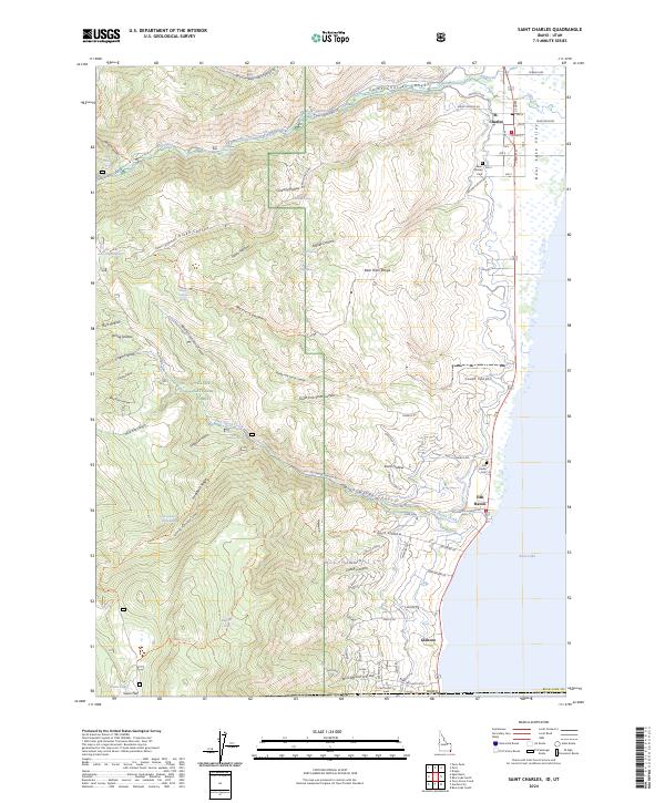
2024 Map of Saint Charles
USGS Topo · Published 2024About this map
Bear Lake defines the eastern edge of this Idaho-Utah borderlands region, where the steep canyons of the Bear River Range descend into the valley. Small settlements like St. Charles and Fish Haven are established on the alluvial fans where mountain drainages meet the lake shore. The terrain is deeply incised by Saint Charles Creek and Fish Haven Canyon, creating a complex network of ridges like Hogsback Ridge and numerous named hollows. This high-altitude landscape is largely protected within the Cache National Forest, showing a distinct transition from the wild canyons of the interior to the agricultural and residential pockets near the water. Local history is anchored by the Saint Charles Cem and Fish Haven Cem, while the presence of Swan Lake and various springs like Alkali Spring and Blue Pond Spring indicate the critical role of water management in this semi-arid environment.
Find a feature on this map
86 named features on this map. Tap any name to fly to it.
Don’t see what you’re looking for? This feature index may not catch every label — zoom into the map to look around manually.
Map Details
Editions of this 2024 Saint Charles Map
This is the sole edition of this map. No revisions or reprints were ever made.
Other maps of this area

1909 · Montpelier
USGS Topo · 1:125,000

1911 · Montpelier
USGS Topo · 1:125,000

1912 · Randolph
USGS Topo · 1:125,000

1914 · Logan
USGS Topo · 1:125,000

1915 · Preston
USGS Topo · 1:96,000

1916 · Logan
USGS Topo · 1:125,000

1918 · Preston
USGS Topo · 1:125,000

1954 · Ogden
USGS Topo · 1:250,000

1955 · Preston
USGS Topo · 1:250,000

1958 · Ogden
USGS Topo · 1:250,000