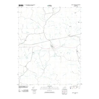
2010 Map of Saint Charles
USGS Topo · Published 2010About this map
Saint Charles sits at the heart of this Western Kentucky landscape, where a transition from earlier mining and rail infrastructure to a modern transportation network is evident. The passage of the Western Kentucky Pkwy bisects the terrain, yet older local arteries like Buttermilk Rd and Suthards Church Rd continue to connect long-established settlements. Small communities such as Hamby and Ilsley are detailed alongside family and community landmarks like Union Temple Cemetery and Gamblin Cemetery, providing valuable points of reference for genealogical research. The region's geography is defined by numerous waterways, including Caney Creek and Copper Creek, which weave through named rises like Cat Hill and the Barnsley Hills. Industrial history is noted at the Ilsley Siding and along Homestead Mine Rd, while bodies of water like Magic Lake and Homestead Lake indicate the significant physical changes to the landscape following local extraction activities.
Find a feature on this map
50 named features on this map. Tap any name to fly to it.
Don’t see what you’re looking for? This feature index may not catch every label — zoom into the map to look around manually.
Map Details
Editions of this 2010 Saint Charles Map
This is the sole edition of this map. No revisions or reprints were ever made.
Other maps of this area

1907 · Earlington
USGS Topo · 1:48,000

1909 · Dawson Springs
USGS Topo · 1:48,000

1909 · Earlington
USGS Topo · 1:62,500

1909 · Madisonville
USGS Topo · 1:62,500

1911 · Dawson Springs
USGS Topo · 1:62,500

1912 · Nortonville
USGS Topo · 1:62,500

1952 · Crofton
USGS Topo · 1:24,000

1953 · Dawson Springs SE
USGS Topo · 1:24,000

1953 · Nortonville
USGS Topo · 1:24,000

1953 · Madisonville East
USGS Topo · 1:24,000