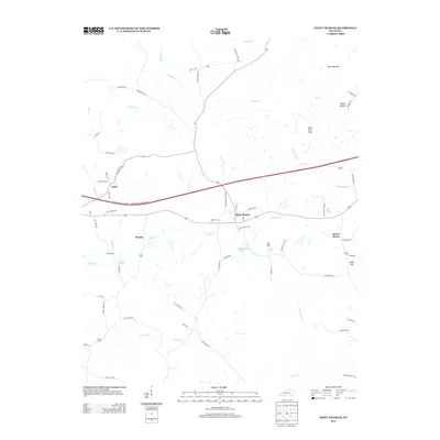
2013 Map of Saint Charles
USGS Topo · Published 2013About this map
The community of Saint Charles serves as a central hub in this western Kentucky landscape, where the Western Kentucky Parkway bisects the terrain. Local history is etched into the road names and small settlements, such as the rail-adjacent Ilsley Siding and the village of Hamby. The area’s industrial and agricultural past is reflected in the numerous water features and family-named landmarks like Carrol Spring and Bald Duck Spring. A complex drainage network defines the geography, with Caney Creek and Copperas Creek threading through the lowlands between the Barnsley Hills and Cat Hill. The presence of labels like Coal Mine Rd and Hughett Mine Rd points to the subsurface legacy that has long shaped the economy of Hopkins County.
Find a feature on this map
72 named features on this map. Tap any name to fly to it.
Don’t see what you’re looking for? This feature index may not catch every label — zoom into the map to look around manually.
Map Details
Editions of this 2013 Saint Charles Map
This is the sole edition of this map. No revisions or reprints were ever made.
Other maps of this area

1907 · Earlington
USGS Topo · 1:48,000

1909 · Dawson Springs
USGS Topo · 1:48,000

1909 · Earlington
USGS Topo · 1:62,500

1909 · Madisonville
USGS Topo · 1:62,500

1911 · Dawson Springs
USGS Topo · 1:62,500

1912 · Nortonville
USGS Topo · 1:62,500

1952 · Crofton
USGS Topo · 1:24,000

1953 · Dawson Springs SE
USGS Topo · 1:24,000

1953 · Nortonville
USGS Topo · 1:24,000

1953 · Madisonville East
USGS Topo · 1:24,000