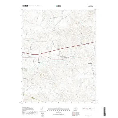
2019 Map of Saint Charles
USGS Topo · Published 2019About this map
St. Charles and its surrounding communities are documented in this modern topographic record of southern Hopkins County. The landscape is defined by its mining and rural history, where the names of long-established family homesteads and mine sites are preserved through the road network, including Hughlette Mine Rd, Coal Mine Rd, and Rialto Mine Rd. Local genealogists will find significant value in the distribution of family-named burial grounds like Hamby Cem and Gamblin Cem, which sit alongside historic church sites such as Christian Privilege Cem. The terrain transitions from the lowlands of Maple Swamp to prominent heights such as The Big Hill and the Barnsley Hills. Settlements like Ilsley and Hamby remain centered near the rail and road corridors that have historically driven the region's economy, while newer features like Magic Lake indicate shifts in land use over time.
Find a feature on this map
61 named features on this map. Tap any name to fly to it.
Don’t see what you’re looking for? This feature index may not catch every label — zoom into the map to look around manually.
Map Details
Editions of this 2019 Saint Charles Map
This is the sole edition of this map. No revisions or reprints were ever made.
Other maps of this area

1907 · Earlington
USGS Topo · 1:48,000

1909 · Dawson Springs
USGS Topo · 1:48,000

1909 · Earlington
USGS Topo · 1:62,500

1909 · Madisonville
USGS Topo · 1:62,500

1911 · Dawson Springs
USGS Topo · 1:62,500

1912 · Nortonville
USGS Topo · 1:62,500

1952 · Crofton
USGS Topo · 1:24,000

1953 · Dawson Springs SE
USGS Topo · 1:24,000

1953 · Nortonville
USGS Topo · 1:24,000

1953 · Madisonville East
USGS Topo · 1:24,000