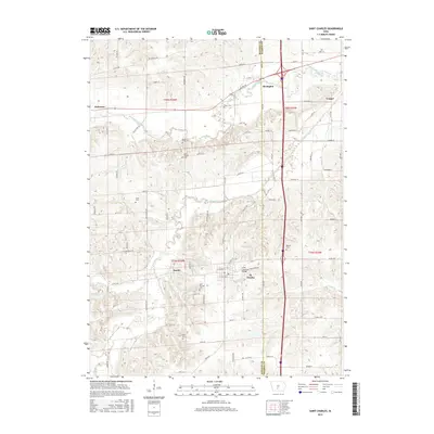
2015 Map of Saint Charles
USGS Topo · Published 2015About this map
St. Charles and its surrounding townships in Madison and Warren Counties are defined by a complex network of prairie streams and rural settlements. The drainage of Middle River, Clanton Cr, and Painter Cr carves through the landscape, influencing the placement of early road corridors like Valleyview Trl and Wildrose Ave. A significant cultural landmark, the Imes Covered Bridge, stands near the southern edge of the survey area, representing the preservation of historic timber construction in this part of Iowa.
Find a feature on this map
83 named features on this map. Tap any name to fly to it.
Don’t see what you’re looking for? This feature index may not catch every label — zoom into the map to look around manually.
Map Details
Editions of this 2015 Saint Charles Map
This is the sole edition of this map. No revisions or reprints were ever made.
Other maps of this area

1931 · Indianola
USGS Topo · 1:62,500

1950 · New Virginia
USGS Topo · 1:62,500

1951 · Osceola
USGS Topo · 1:62,500

1951 · St. Charles
USGS Topo · 1:62,500

1952 · New Virginia
USGS Topo · 1:62,500

1954 · Des Moines
USGS Topo · 1:250,000

1956 · Des Moines
USGS Topo · 1:250,000

1957 · Des Moines
USGS Topo · 1:250,000

1969 · Des Moines
USGS Topo · 1:250,000
1972 · Norwalk
USGS Topo · 1:24,000