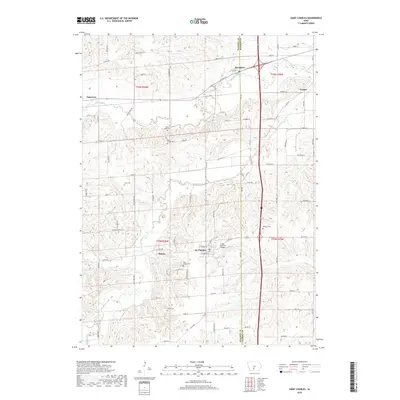
2018 Map of Saint Charles
USGS Topo · Published 2018About this map
St. Charles sits at the intersection of local history and the modern landscape of Madison County, Iowa. This area is characterized by its agricultural valleys and the winding courses of the Middle River and Clanton Cr. A significant landmark of local heritage, the Imes Covered Bridge is situated just northeast of the town center, representing the historical transport infrastructure of the region.
Find a feature on this map
120 named features on this map. Tap any name to fly to it.
Don’t see what you’re looking for? This feature index may not catch every label — zoom into the map to look around manually.
Map Details
Editions of this 2018 Saint Charles Map
This is the sole edition of this map. No revisions or reprints were ever made.
Other maps of this area

1931 · Indianola
USGS Topo · 1:62,500

1950 · New Virginia
USGS Topo · 1:62,500

1951 · Osceola
USGS Topo · 1:62,500

1951 · St. Charles
USGS Topo · 1:62,500

1952 · New Virginia
USGS Topo · 1:62,500

1954 · Des Moines
USGS Topo · 1:250,000

1956 · Des Moines
USGS Topo · 1:250,000

1957 · Des Moines
USGS Topo · 1:250,000

1969 · Des Moines
USGS Topo · 1:250,000
1972 · Norwalk
USGS Topo · 1:24,000