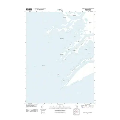
2011 Map of Saint Clair Flats
USGS Topo · Published 2011About this map
The delta of the Saint Clair River unfolds into Lake Saint Clair in this coastal survey, where a complex network of islands and marshy channels defines the landscape. The small settlements of Miller and Riverside sit on the eastern edge of the delta, linked by numerous named waterways that serve as the primary thoroughfares, such as the Middle Channel Saint Clair River and South Channel Saint Clair River. Distinctive island formations including Harsens Island, Dickinson Island, and Gull Island are separated by intricate cuts and bays, illustrating a unique maritime environment where roads are replaced by waterways like Little Fisher Highway and Big Fisher Highway. Historically significant markers like the Old Channel Light stand near the Old Channel, highlighting the navigation hazards and maritime heritage of the Saint Clair Flats.
Find a feature on this map
79 named features on this map. Tap any name to fly to it.
Don’t see what you’re looking for? This feature index may not catch every label — zoom into the map to look around manually.
Map Details
Editions of this 2011 Saint Clair Flats Map
This is the sole edition of this map. No revisions or reprints were ever made.
Other maps of this area

1905 · Grosse Pointe
USGS Topo · 1:62,500

1912 · Mt Clemens
USGS Topo · 1:62,500

1914 · Algonac
USGS Topo · 1:62,500

1918 · Grosse Pointe
USGS Topo · 1:62,500

1929 · Mt Clemens
USGS Topo · 1:62,500

1936 · New Haven
USGS Topo · 1:31,680

1936 · Selfridge Field
USGS Topo · 1:31,680

1936 · New Baltimore
USGS Topo · 1:31,680

1936 · Algonac
USGS Topo · 1:31,680

1939 · New Baltimore
USGS Topo · 1:24,000