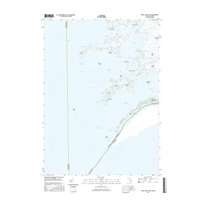
2017 Map of Saint Clair Flats
USGS Topo · Published 2017About this map
The intricate delta of the Saint Clair Flats marks the aquatic boundary between Michigan and Ontario, where the Saint Clair River branches into Lake Saint Clair. This landscape is defined by a complex network of marshes, islands, and narrow waterways known as highways, such as the Belt Highway and Baltimore Highway. The primary landmasses like Harsens Island and Dickinson Island are connected to smaller features including McDonald Island and Bruckner Island, many of which supported seasonal and permanent residences reached only by water or narrow roads.
Find a feature on this map
82 named features on this map. Tap any name to fly to it.
Don’t see what you’re looking for? This feature index may not catch every label — zoom into the map to look around manually.
Map Details
Editions of this 2017 Saint Clair Flats Map
This is the sole edition of this map. No revisions or reprints were ever made.
Other maps of this area

1905 · Grosse Pointe
USGS Topo · 1:62,500

1912 · Mt Clemens
USGS Topo · 1:62,500

1914 · Algonac
USGS Topo · 1:62,500

1918 · Grosse Pointe
USGS Topo · 1:62,500

1929 · Mt Clemens
USGS Topo · 1:62,500

1936 · New Haven
USGS Topo · 1:31,680

1936 · Selfridge Field
USGS Topo · 1:31,680

1936 · New Baltimore
USGS Topo · 1:31,680

1936 · Algonac
USGS Topo · 1:31,680

1939 · New Baltimore
USGS Topo · 1:24,000