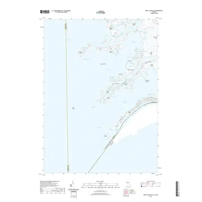
2019 Map of Saint Clair Flats
USGS Topo · Published 2019About this map
The intricate delta environment of the Saint Clair Flats is revealed in this 2019 survey, illustrating the complex intersection of land and water where the Saint Clair River meets Lake Saint Clair. This unique freshwater archipelago is defined by its extensive marshlands and narrow distributary channels, including the South Channel and Middle Channel. Small settlements like Miller and Riverside sit along the southeastern shores of Harsens Island, connected by a network of uniquely named thoroughfares such as Maybury Highway and Peninsular Highway.
Find a feature on this map
77 named features on this map. Tap any name to fly to it.
Don’t see what you’re looking for? This feature index may not catch every label — zoom into the map to look around manually.
Map Details
Editions of this 2019 Saint Clair Flats Map
This is the sole edition of this map. No revisions or reprints were ever made.
Other maps of this area

1905 · Grosse Pointe
USGS Topo · 1:62,500

1912 · Mt Clemens
USGS Topo · 1:62,500

1914 · Algonac
USGS Topo · 1:62,500

1918 · Grosse Pointe
USGS Topo · 1:62,500

1929 · Mt Clemens
USGS Topo · 1:62,500

1936 · New Haven
USGS Topo · 1:31,680

1936 · Selfridge Field
USGS Topo · 1:31,680

1936 · New Baltimore
USGS Topo · 1:31,680

1936 · Algonac
USGS Topo · 1:31,680

1939 · New Baltimore
USGS Topo · 1:24,000