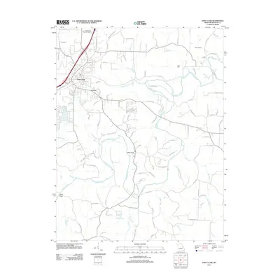
2012 Map of Saint Clair
USGS Topo · Published 2012About this map
The Meramec River winds through the heart of this Franklin County landscape, creating a complex geography of bends and valleys that define the local settlement patterns. In the northwest, Saint Clair serves as a major hub, bordered by the Saint Clair Regional Airport and residential developments like Parkway. The river's influence is evident in the many crossings and waterside communities, including Piney Park and the crossing at Plum Ford to the southwest. Away from the main river corridor, the terrain transitions into more rural areas marked by family history and small watercourses like Happy Sock Creek and Birch Creek. Genealogists may find value in the documentation of local burial grounds, such as Fisher Cemetery and Cove Cemetery, which are situated near Cove Spring and the distinctive summit of Lost Hill in the northeastern portion of the quadrangle.
Find a feature on this map
105 named features on this map. Tap any name to fly to it.
Don’t see what you’re looking for? This feature index may not catch every label — zoom into the map to look around manually.
Map Details
Editions of this 2012 Saint Clair Map
This is the sole edition of this map. No revisions or reprints were ever made.
Other maps of this area

1901 · De Soto
USGS Topo · 1:125,000

1903 · Sullivan
USGS Topo · 1:125,000

1934 · Meramec State Park
USGS Topo · 1:24,000

1937 · Meramec State Park
USGS Topo · 1:24,000

1946 · Richwoods
USGS Topo · 1:62,500

1946 · Union
USGS Topo · 1:62,500

1947 · Sullivan
USGS Topo · 1:62,500

1947 · St. Clair
USGS Topo · 1:62,500

1948 · Richwoods
USGS Topo · 1:62,500

1948 · Union
USGS Topo · 1:62,500