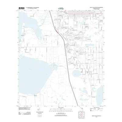
2012 Map of Saint Cloud South
USGS Topo · Published 2012About this map
Lake Tohopekaliga dominates the western landscape of this survey, with its eastern shores meeting a network of residential developments and agricultural tracts. The map illustrates the transition from the lakeside environment at Friars Cove to the suburban street grids expanding south of the central town area. To the north, Mount Peace Cem serves as a significant genealogical landmark, while the southern reaches feature the smaller Lake Gentry and the adjacent Gentry Airport. Settlement patterns are anchored by established locations like Kissimmee Park and South Port, connected by a dense lattice of named local roads such as Cecil Whaley Rd and Kissimmee Park Rd. This documentation of the area's geography captures the intersection of Florida's freshwater systems and the ongoing residential expansion in the early 21st century.
Find a feature on this map
142 named features on this map. Tap any name to fly to it.
Don’t see what you’re looking for? This feature index may not catch every label — zoom into the map to look around manually.
Map Details
Editions of this 2012 Saint Cloud South Map
This is the sole edition of this map. No revisions or reprints were ever made.
Other maps of this area

1953 · Cypress Lake
USGS Topo · 1:24,000

1953 · Lake Hatchineha
USGS Topo · 1:24,000

1953 · St Cloud North
USGS Topo · 1:24,000

1953 · Narcoossee
USGS Topo · 1:24,000

1953 · St Cloud South
USGS Topo · 1:24,000

1953 · Lake Tohopekaliga
USGS Topo · 1:24,000

1953 · Holopaw SW
USGS Topo · 1:24,000

1953 · Ashton
USGS Topo · 1:24,000

1953 · Kissimmee
USGS Topo · 1:24,000

1955 · Orlando
USGS Topo · 1:250,000