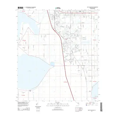
2015 Map of Saint Cloud South
USGS Topo · Published 2015About this map
Saint Cloud and its southern suburban expansion define the landscape in this 2015 study of northern Osceola County. The residential grid is anchored by the Mount Peace Cem in the northeast, while the western edge is dominated by the vast shoreline of Lake Tohopekaliga and its connecting Saint Cloud Canal. The map reveals a transition from the established street patterns of the city to the more complex suburban developments like Michigan Estates, reflecting the rapid growth of the Orlando metropolitan area into former agricultural and citrus lands. To the south, the terrain becomes more open near South Port and the Gentry Airport, where the drainage patterns of Gator Bay Br weave through the low-lying Florida landscape. This record captures the precise state of regional development and water management infrastructure, including the isolated landform of Dick Island near the lake’s northern reaches.
Find a feature on this map
156 named features on this map. Tap any name to fly to it.
Don’t see what you’re looking for? This feature index may not catch every label — zoom into the map to look around manually.
Map Details
Editions of this 2015 Saint Cloud South Map
This is the sole edition of this map. No revisions or reprints were ever made.
Other maps of this area

1953 · Cypress Lake
USGS Topo · 1:24,000

1953 · Lake Hatchineha
USGS Topo · 1:24,000

1953 · St Cloud North
USGS Topo · 1:24,000

1953 · Narcoossee
USGS Topo · 1:24,000

1953 · St Cloud South
USGS Topo · 1:24,000

1953 · Lake Tohopekaliga
USGS Topo · 1:24,000

1953 · Holopaw SW
USGS Topo · 1:24,000

1953 · Ashton
USGS Topo · 1:24,000

1953 · Kissimmee
USGS Topo · 1:24,000

1955 · Orlando
USGS Topo · 1:250,000