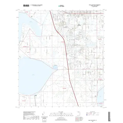
2018 Map of Saint Cloud South
USGS Topo · Published 2018About this map
St. Cloud serves as the primary urban center in this northern section of Osceola County, where a grid of state-named streets such as Louisiana Ave and Pennsylvania Ave transitions into suburban developments and wetlands. The landscape is defined by its sophisticated water management system, centered on the expansive Lake Tohopekaliga and the Saint Cloud Canal. The southern reaches of the map show the transition from residential areas to rural landscapes near South Port, punctuated by water bodies like Lake Gentry and Fanny Bass Pond.
Find a feature on this map
137 named features on this map. Tap any name to fly to it.
Don’t see what you’re looking for? This feature index may not catch every label — zoom into the map to look around manually.
Map Details
Editions of this 2018 Saint Cloud South Map
This is the sole edition of this map. No revisions or reprints were ever made.
Other maps of this area

1953 · Cypress Lake
USGS Topo · 1:24,000

1953 · Lake Hatchineha
USGS Topo · 1:24,000

1953 · St Cloud North
USGS Topo · 1:24,000

1953 · Narcoossee
USGS Topo · 1:24,000

1953 · St Cloud South
USGS Topo · 1:24,000

1953 · Lake Tohopekaliga
USGS Topo · 1:24,000

1953 · Holopaw SW
USGS Topo · 1:24,000

1953 · Ashton
USGS Topo · 1:24,000

1953 · Kissimmee
USGS Topo · 1:24,000

1955 · Orlando
USGS Topo · 1:250,000