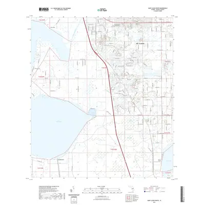
2021 Map of Saint Cloud South
USGS Topo · Published 2021About this map
St. Cloud serves as the northern anchor of this landscape, showing the suburban expansion and residential development characteristic of modern Osceola County. The map details a transition from the structured street grid of the city, including its Technical Education Center, to the vast wetlands and hydrological systems that dominate the southern reaches. Major water bodies like Lake Tohopekaliga and the smaller Lake Gentry are connected by a network of engineered waterways, including the Saint Cloud Canal and South Port Canal, reflecting decades of water management in the Florida interior.
Find a feature on this map
145 named features on this map. Tap any name to fly to it.
Don’t see what you’re looking for? This feature index may not catch every label — zoom into the map to look around manually.
Map Details
Editions of this 2021 Saint Cloud South Map
This is the sole edition of this map. No revisions or reprints were ever made.
Other maps of this area

1953 · Cypress Lake
USGS Topo · 1:24,000

1953 · Lake Hatchineha
USGS Topo · 1:24,000

1953 · St Cloud North
USGS Topo · 1:24,000

1953 · Narcoossee
USGS Topo · 1:24,000

1953 · St Cloud South
USGS Topo · 1:24,000

1953 · Lake Tohopekaliga
USGS Topo · 1:24,000

1953 · Holopaw SW
USGS Topo · 1:24,000

1953 · Ashton
USGS Topo · 1:24,000

1953 · Kissimmee
USGS Topo · 1:24,000

1955 · Orlando
USGS Topo · 1:250,000