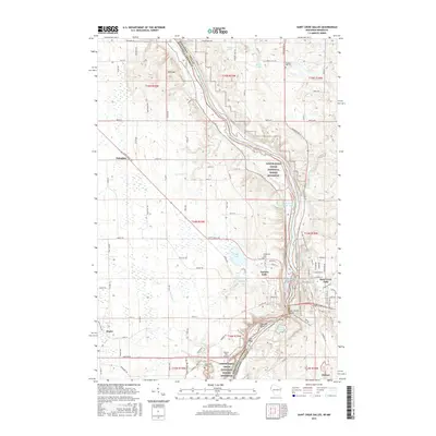
2015 Map of Saint Croix Dalles
USGS Topo · Published 2015About this map
Saint Croix River serves as the focal point of this survey, carving through the border between Minnesota and Wisconsin. The twin settlements of Taylors Falls and Saint Croix Falls anchor the central portion of the map, connected by Highway 8 at the river crossing. This area is characterized by the dramatic geology of the Saint Croix Dalles, where the river narrows between rock formations. To the south, Lake O' the Dalles and Folsom Island highlight the recreation-focused landscape of the Lower Saint Croix National Scenic Riverway. Further west, the terrain rises toward Wild Mtn, while small communities like Shafer and Franconia mark the transition into the agricultural uplands. Local history is preserved in sites such as Kahbakong Cem and Pleasant Hill Cem, which sit atop the bluffs overlooking the river valley.
Find a feature on this map
125 named features on this map. Tap any name to fly to it.
Don’t see what you’re looking for? This feature index may not catch every label — zoom into the map to look around manually.
Map Details
Editions of this 2015 Saint Croix Dalles Map
This is the sole edition of this map. No revisions or reprints were ever made.
Other maps of this area

1900 · St Croix Dalles
USGS Topo · 1:62,500

1901 · St Croix Dalles
USGS Topo · 1:62,500

1950 · Rush City
USGS Topo · 1:48,000

1951 · Milltown
USGS Topo · 1:48,000

1953 · Stillwater
USGS Topo · 1:250,000

1955 · St. Croix Dalles
USGS Topo · 1:62,500

1955 · Rush City
USGS Topo · 1:62,500

1955 · Milltown
USGS Topo · 1:62,500

1955 · Forest Lake
USGS Topo · 1:62,500

1955 · Stillwater
USGS Topo · 1:250,000