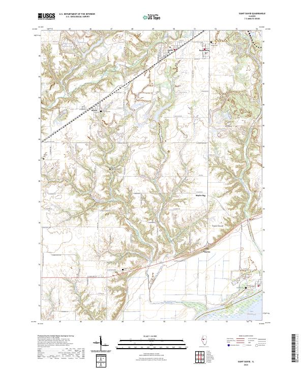
2024 Map of Saint David
USGS Topo · Published 2024About this map
The Illinois River corridor in Fulton County defines this landscape, where the flat river bottom meets the dissected uplands of central Illinois. Near the southern edge, the Chautauqua National Wildlife Refuge and Lake Chautauqua sit adjacent to the river, while the unusual Tampico Mounds rise above the surrounding floodplains. This area reflects a long history of settlement and burial, evidenced by numerous family and community sites including Maryville Cem, Salem Wilcoxen Cem, and High Bridge Cem.
Find a feature on this map
79 named features on this map. Tap any name to fly to it.
Don’t see what you’re looking for? This feature index may not catch every label — zoom into the map to look around manually.
Map Details
Editions of this 2024 Saint David Map
This is the sole edition of this map. No revisions or reprints were ever made.
Other maps of this area

1912 · Canton
USGS Topo · 1:62,500

1925 · Havana
USGS Topo · 1:62,500

1929 · Manito
USGS Topo · 1:62,500

1930 · Glasford
USGS Topo · 1:62,500

1932 · Manito
USGS Topo · 1:62,500

1947 · Lewistown
USGS Topo · 1:24,000

1947 · St. David
USGS Topo · 1:24,000

1947 · Havana
USGS Topo · 1:24,000

1948 · Duncan Mills
USGS Topo · 1:24,000

1948 · Lewistown
USGS Topo · 1:24,000