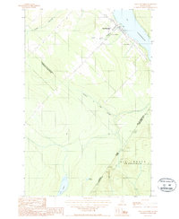
1987 Map of Saint-Eleuthere
USGS Topo · Published 1987About this map
Saint-Éleuthère serves as the primary settlement on this international border map, situated on the western shore of Lac Pohénégamook. The landscape is defined by the rigid geopolitical boundary between Canada and the United States, separating the Province of Québec from Maine. The Canadian side features a developed infrastructure with a Hospital, a Cim (cemetery), and a Station Pompage, while the Maine side, specifically Big Twenty, is characterized by more isolated terrain. A single Private Road cuts through the timberlands south of the border, providing access to the interior near Lac à Michel. Waterways like Rivière Boucanée and Ruisseau du Chat Sauvage drain the hilly topography, illustrating the watershed of the Saint John River valley during the late 1980s. This survey records the distinct contrast between the concentrated municipal growth of the Municipalité de Ville de Pohénégamook and the unorganized territories of Aroostook County.
Find a feature on this map
18 named features on this map. Tap any name to fly to it.
Don’t see what you’re looking for? This feature index may not catch every label — zoom into the map to look around manually.
Map Details
Editions of this 1987 Saint-Eleuthere Map
This is the sole edition of this map. No revisions or reprints were ever made.
Other maps of this area

1955 · Rocky Brook
USGS Topo · 1:62,500

1955 · Beau Lake
USGS Topo · 1:62,500

1962 · Edmundston
USGS Topo · 1:250,000

1987 · Hafey Pond
USGS Topo · 1:24,000
1987 · Morrison Brook
USGS Topo · 1:24,000
1987 · Estcourt
USGS Topo · 1:24,000
1987 · Rocky Brook
USGS Topo · 1:24,000
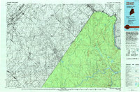
1993 · Allagash
USGS Topo · 1:100,000
2011 · Saint Eleuthere
USGS Topo · 1:24,000
2011 · Rocky Brook
USGS Topo · 1:24,000