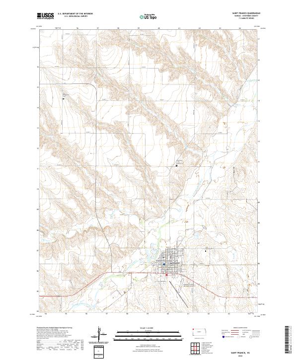
2022 Map of Saint Francis
USGS Topo · Published 2022About this map
The S Fork Republican River defines the lower geography of this Cheyenne County region, where the town of St. Francis serves as a prominent local hub. The layout of the town is anchored by the Cheyenne County Courthouse, surrounded by a grid that includes the Saint Francis Cem to the east and the Cheyenne County Municipal Airport to the south. The surrounding prairie is dissected by numerous drainages, including Plum Cr, Cherry Cr, and Cleveland Run, illustrating the complex water network essential for high plains agriculture.
Find a feature on this map
27 named features on this map. Tap any name to fly to it.
Don’t see what you’re looking for? This feature index may not catch every label — zoom into the map to look around manually.
Map Details
Editions of this 2022 Saint Francis Map
This is the sole edition of this map. No revisions or reprints were ever made.
Other maps of this area

1942 · St. Francis
USGS Topo · 1:62,500

1943 · St. Francis
USGS Topo · 1:62,500

1951 · St Francis
USGS Topo · 1:62,500

1951 · Bird City North
USGS Topo · 1:62,500

1951 · Bird City South
USGS Topo · 1:62,500

1952 · St Francis 3
USGS Topo · 1:62,500

1954 · Goodland
USGS Topo · 1:250,000

1956 · Goodland
USGS Topo · 1:250,000

1957 · Goodland
USGS Topo · 1:250,000
1976 · White Canyon
USGS Topo · 1:24,000