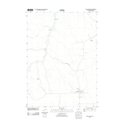
2012 Map of Saint Francis
USGS Topo · Published 2012About this map
Saint Francis serves as a primary settlement center in this portion of Todd County, located south of the meandering Little White River. The landscape is defined by the river’s drainage basin, where smaller tributaries like Omaha Cr and S Ironwood Cr cut through the terrain. Significant infrastructure connects these rural areas, including the Two Strike Bridge and the Iron Shell Bridge, which provide essential crossings over the main waterway. To the west, the prominence of Grass Mountain stands as a clear landmark above the surrounding plains.
Find a feature on this map
18 named features on this map. Tap any name to fly to it.
Don’t see what you’re looking for? This feature index may not catch every label — zoom into the map to look around manually.
Map Details
Editions of this 2012 Saint Francis Map
This is the sole edition of this map. No revisions or reprints were ever made.
Other maps of this area

1955 · Martin
USGS Topo · 1:250,000

1958 · Martin
USGS Topo · 1:250,000

1969 · Soldier Creek
USGS Topo · 1:24,000

1969 · Parmelee
USGS Topo · 1:24,000

1969 · Iron Shell Flat East
USGS Topo · 1:24,000

1969 · Soldier Creek SE
USGS Topo · 1:24,000

1969 · Rosebud
USGS Topo · 1:24,000

1969 · Spring Creek
USGS Topo · 1:24,000

1969 · St. Francis SW
USGS Topo · 1:24,000
1969 · St. Francis
USGS Topo · 1:24,000
Featured Places
- Rosebud, SD
- St. Francis Segment, SD
- Two Strike Segment, SD
- Grass Mountain Segment, SD
- Two Strike, Two Strike Segment