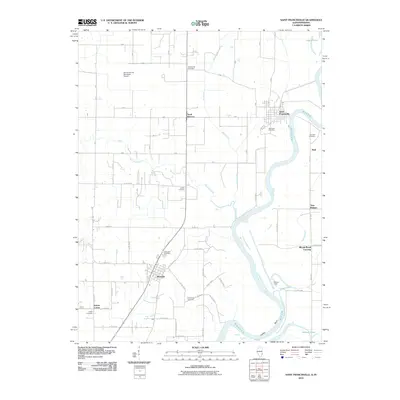
2010 Map of Saint Francisville
USGS Topo · Published 2010About this map
The Wabash River carves a winding path along the Illinois-Indiana border, defining the eastern edge of this 2010 topographic record. In the center of the landscape, the town of Allendale serves as a hub for the surrounding rural territory, while Saint Francisville sits perched on the riverbank to the northeast. The area is notable for its high concentration of family and community burial grounds, including Bunker Hill Cemetery, Oak Lawn Cemetery, and Allendale Cemetery, which provide essential clues for genealogical research.
Find a feature on this map
26 named features on this map. Tap any name to fly to it.
Don’t see what you’re looking for? This feature index may not catch every label — zoom into the map to look around manually.
Map Details
Editions of this 2010 Saint Francisville Map
This is the sole edition of this map. No revisions or reprints were ever made.
Other maps of this area

1901 · Princeton
USGS Topo · 1:62,500

1903 · Princeton
USGS Topo · 1:62,500

1903 · Patoka
USGS Topo · 1:125,000

1904 · Mount Carmel
USGS Topo · 1:62,500

1911 · Sumner
USGS Topo · 1:62,500

1913 · Sumner
USGS Topo · 1:62,500

1915 · Vincennes
USGS Topo · 1:62,500

1944 · Vincennes
USGS Topo · 1:62,500

1956 · Vincennes
USGS Topo · 1:250,000

1957 · Vincennes
USGS Topo · 1:250,000