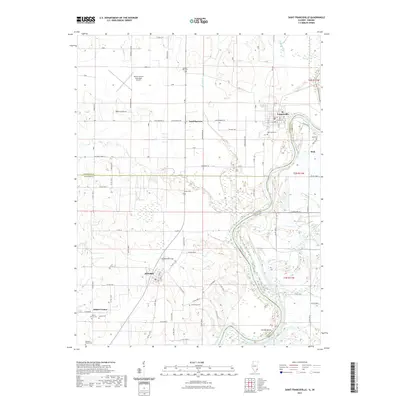
2021 Map of Saint Francisville
USGS Topo · Published 2021About this map
The Wabash River carves a sweeping path along the boundary between Illinois and Indiana, defining the eastern character of this Lawrence and Wabash County landscape. Near the river's bend, St. Francisville serves as a local hub, while the interior is dotted with small agricultural settlements like Allendale and Adams Corner. The region's history is well-preserved through numerous burial grounds, including the Stillwell Family Cem and Oak Lawn Cem, which provide essential points of reference for genealogists tracking early families in the area.
Find a feature on this map
84 named features on this map. Tap any name to fly to it.
Don’t see what you’re looking for? This feature index may not catch every label — zoom into the map to look around manually.
Map Details
Editions of this 2021 Saint Francisville Map
This is the sole edition of this map. No revisions or reprints were ever made.
Other maps of this area

1901 · Princeton
USGS Topo · 1:62,500

1903 · Princeton
USGS Topo · 1:62,500

1903 · Patoka
USGS Topo · 1:125,000

1904 · Mount Carmel
USGS Topo · 1:62,500

1911 · Sumner
USGS Topo · 1:62,500

1913 · Sumner
USGS Topo · 1:62,500

1915 · Vincennes
USGS Topo · 1:62,500

1944 · Vincennes
USGS Topo · 1:62,500

1956 · Vincennes
USGS Topo · 1:250,000

1957 · Vincennes
USGS Topo · 1:250,000