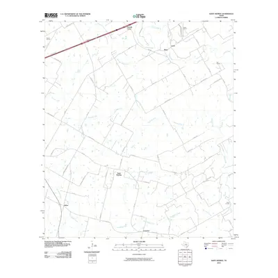
2010 Map of Saint Hedwig
USGS Topo · Published 2010About this map
Saint Hedwig serves as the central hub of this eastern Bexar County landscape, where the rural heritage of the Texas coastal plains meets modern infrastructure. The terrain is defined by a network of seasonal drainages, including Martinez Creek and Womans Hollow Creek, which flow toward the more prominent Cibolo Creek along the northeastern boundary. In the north, Zuehl Airport and Idle Airpark signal the area's aviation presence, while smaller community centers like Zuehl, Adkins, and Carpenter are linked by a grid of county roads. The settlement pattern remains largely agricultural and residential, punctuated by localized landmarks such as the Kempin Cemetery and the geographic point known as Friendly Corner at the edge of the interstate access corridor. This survey captures a moment of transition as traditional ranching and farming lands in the San Antonio hinterlands are increasingly partitioned by a complex web of named roads and family-owned properties.
Find a feature on this map
54 named features on this map. Tap any name to fly to it.
Don’t see what you’re looking for? This feature index may not catch every label — zoom into the map to look around manually.
Map Details
Editions of this 2010 Saint Hedwig Map
This is the sole edition of this map. No revisions or reprints were ever made.
Other maps of this area

1924 · New Braunfels No 4
USGS Topo · 1:48,000

1927 · New Braunfels
USGS Topo · 1:62,500

1953 · Schertz
USGS Topo · 1:24,000

1953 · Elmendorf
USGS Topo · 1:24,000

1953 · Martinez
USGS Topo · 1:24,000

1954 · San Antonio
USGS Topo · 1:250,000

1957 · San Antonio
USGS Topo · 1:250,000

1957 · New Berlin
USGS Topo · 1:24,000

1958 · Marion
USGS Topo · 1:24,000

1958 · La Vernia SW
USGS Topo · 1:24,000