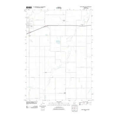
2010 Map of Saint James East
USGS Topo · Published 2010About this map
The South Fork Watonwan River meanders through this agricultural landscape in southern Minnesota, defining the drainage patterns for the surrounding townships. The small community of South Branch sits near the southern edge of the sheet, served by a network of county highways including County Hwy-101 and County Hwy-12. For genealogists, the map is particularly valuable for locating the Sell-Lamb Cemetery tucked along the riverbanks and the Mount Hope Cemetery near the western boundary. Local infrastructure is anchored by the Saint James Municipal Airport and the Watonwan County Fairgrounds, indicating the area's importance as a regional hub for both commerce and community events. Natural features like Bullhead Lake and various tributaries such as Willow Creek and Spring Branch Creek interrupt the geometric grid of farm roads and fields.
Find a feature on this map
23 named features on this map. Tap any name to fly to it.
Don’t see what you’re looking for? This feature index may not catch every label — zoom into the map to look around manually.
Map Details
Editions of this 2010 Saint James East Map
This is the sole edition of this map. No revisions or reprints were ever made.
Other maps of this area

1953 · New Ulm
USGS Topo · 1:250,000

1954 · Fairmont
USGS Topo · 1:250,000

1957 · New Ulm
USGS Topo · 1:250,000

1958 · New Ulm
USGS Topo · 1:250,000

1958 · Fairmont
USGS Topo · 1:250,000

1965 · Madelia
USGS Topo · 1:24,000

1967 · New Ulm
USGS Topo · 1:250,000

1967 · Truman
USGS Topo · 1:24,000

1967 · Lewisville
USGS Topo · 1:24,000

1967 · Godahl
USGS Topo · 1:24,000