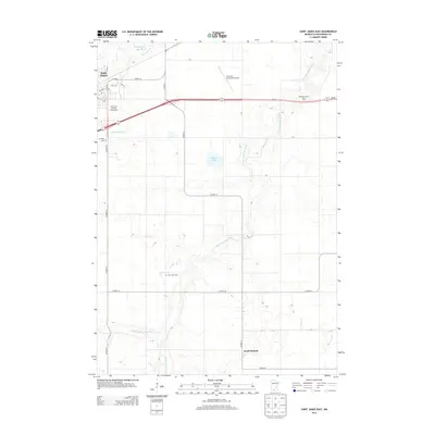
2013 Map of Saint James East
USGS Topo · Published 2013About this map
The S Fork Watonwan River meanders across this agricultural landscape of Watonwan County, defining the drainage patterns of the region south of Saint James. The northern edge of the map captures the transition from the municipal grid of Saint James to the expansive fields and scattered homesteads typical of southern Minnesota. Cultural landmarks such as the Watonwan County Fairgrounds and St James Municipal Airport indicate the area's role as a local center for commerce and aviation. Genealogists will find interest in the documented locations of Mt Hope Cem and the more remote Sell-Lamb Cem, which sit amidst a network of county roads. The terrain is dotted with significant water features including the One Hundred Acre Slough and Bullhead Lake, illustrating the post-glacial hydrology of the plains.
Find a feature on this map
22 named features on this map. Tap any name to fly to it.
Don’t see what you’re looking for? This feature index may not catch every label — zoom into the map to look around manually.
Map Details
Editions of this 2013 Saint James East Map
This is the sole edition of this map. No revisions or reprints were ever made.
Other maps of this area

1953 · New Ulm
USGS Topo · 1:250,000

1954 · Fairmont
USGS Topo · 1:250,000

1957 · New Ulm
USGS Topo · 1:250,000

1958 · New Ulm
USGS Topo · 1:250,000

1958 · Fairmont
USGS Topo · 1:250,000

1965 · Madelia
USGS Topo · 1:24,000

1967 · New Ulm
USGS Topo · 1:250,000

1967 · Truman
USGS Topo · 1:24,000

1967 · Lewisville
USGS Topo · 1:24,000

1967 · Godahl
USGS Topo · 1:24,000