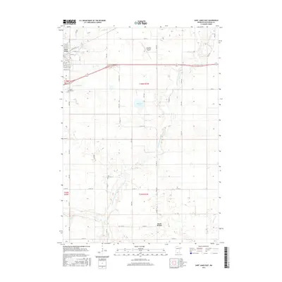
2016 Map of Saint James East
USGS Topo · Published 2016About this map
Saint James sits at the northwestern edge of this Watonwan County landscape, serving as a gateway to the fertile prairie of southern Minnesota. The terrain is defined by the winding course of the S Fork Watonwan River and its various tributaries, including Saint James Cr and Willow Cr. These waterways carve a natural network through a strictly organized grid of county roads and sections, reflecting the region's deep agricultural roots. Small bodies of water like Bullhead Lake and the drainage of Spring Br Cr further characterize the hydrology of this plains environment.
Find a feature on this map
35 named features on this map. Tap any name to fly to it.
Don’t see what you’re looking for? This feature index may not catch every label — zoom into the map to look around manually.
Map Details
Editions of this 2016 Saint James East Map
This is the sole edition of this map. No revisions or reprints were ever made.
Other maps of this area

1953 · New Ulm
USGS Topo · 1:250,000

1954 · Fairmont
USGS Topo · 1:250,000

1957 · New Ulm
USGS Topo · 1:250,000

1958 · New Ulm
USGS Topo · 1:250,000

1958 · Fairmont
USGS Topo · 1:250,000

1965 · Madelia
USGS Topo · 1:24,000

1967 · New Ulm
USGS Topo · 1:250,000

1967 · Truman
USGS Topo · 1:24,000

1967 · Lewisville
USGS Topo · 1:24,000

1967 · Godahl
USGS Topo · 1:24,000