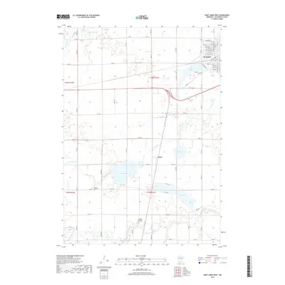
2019 Map of Saint James West
USGS Topo · Published 2019About this map
St. James serves as the primary urban center in this corner of Watonwan County, surrounded by a glaciated landscape defined by its numerous prairie basins and wetlands. The settlement of Echols sits further south along a north-south roadway, marking a quiet rural crossroads. The area's agricultural character is interspersed with several significant bodies of water, including Saint James Lake, Mary Lake, and the expansive Kansas Lake.
Find a feature on this map
65 named features on this map. Tap any name to fly to it.
Don’t see what you’re looking for? This feature index may not catch every label — zoom into the map to look around manually.
Map Details
Editions of this 2019 Saint James West Map
This is the sole edition of this map. No revisions or reprints were ever made.
Other maps of this area

1953 · New Ulm
USGS Topo · 1:250,000

1954 · Fairmont
USGS Topo · 1:250,000

1957 · New Ulm
USGS Topo · 1:250,000

1958 · New Ulm
USGS Topo · 1:250,000

1958 · Fairmont
USGS Topo · 1:250,000

1967 · New Ulm
USGS Topo · 1:250,000

1967 · Godahl
USGS Topo · 1:24,000

1967 · Darfur
USGS Topo · 1:24,000
1967 · La Salle
USGS Topo · 1:24,000

1970 · St James SE
USGS Topo · 1:24,000