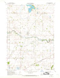
1967 Map of La Salle
USGS Topo · Published 1969About this map
Lake Hanska dominates the northern landscape of this Watonwan County region, where a prominent spillway regulates the water levels near Fort Hill. The terrain is defined by a dense network of drainage and transport, with the Watonwan River meandering eastward across the center of the sheet. The small settlement of La Salle serves as a local hub, situated at the junction of the Chicago and North Western railway and regional roads. Further south, the map reveals the smaller community of Grogan and the Rosendale Ch, illustrating the distributed rural nature of the late 1960s. The landscape is dotted with numerous Gravel Pits, signaling the local importance of aggregate mining. Water features like Butterfield Creek and the curiously named One Hundred Acre Slough highlight the low-lying prairie hydrology that precedes the modern agricultural drainage patterns of the area.
Find a feature on this map
23 named features on this map. Tap any name to fly to it.
Don’t see what you’re looking for? This feature index may not catch every label — zoom into the map to look around manually.
Map Details
Editions of this 1967 La Salle Map
2 editions found
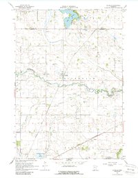
Other maps of this area

1953 · New Ulm
USGS Topo · 1:250,000

1954 · Fairmont
USGS Topo · 1:250,000

1957 · New Ulm
USGS Topo · 1:250,000

1958 · New Ulm
USGS Topo · 1:250,000

1958 · Fairmont
USGS Topo · 1:250,000

1965 · Madelia
USGS Topo · 1:24,000

1965 · Hanska
USGS Topo · 1:24,000

1967 · New Ulm
USGS Topo · 1:250,000

1967 · Lake Hanska West
USGS Topo · 1:24,000

1967 · Lewisville
USGS Topo · 1:24,000