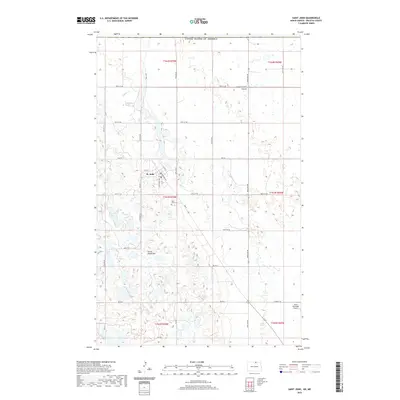
2020 Map of Saint John
USGS Topo · Published 2020About this map
The settlement of St. John sits at the base of the Turtle Mountains, serving as a gateway to this unique upland region on the edge of the Canadian border. This 2020 survey illustrates the organized grid of the township as it meets the more varied, lake-dotted terrain to the south and west. Local landmarks such as the Saint John Cem and the Rolla Municipal Airport provide anchor points for those researching family history in Rolette County. The hydrology of the area is defined by the winding course of Gimby Cr and the marshy expanses of Hidden Island Coulee, which contrast with the open agricultural sections north of the mountains. A network of rural routes, including HWY 43 and several Bureau of Indian Affairs roads like Bia RD 2, connects the community to the surrounding prairie and neighboring regions across the international boundary.
Find a feature on this map
36 named features on this map. Tap any name to fly to it.
Don’t see what you’re looking for? This feature index may not catch every label — zoom into the map to look around manually.
Map Details
Editions of this 2020 Saint John Map
This is the sole edition of this map. No revisions or reprints were ever made.
Other maps of this area

1936 · Lake Upsilon
USGS Topo · 1:48,000

1942 · Lake Upsilon
USGS Topo · 1:62,500

1953 · Devils Lake
USGS Topo · 1:250,000

1956 · Devils Lake
USGS Topo · 1:250,000

1968 · Lake Upsilon SE
USGS Topo · 1:24,000
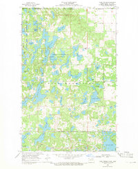
1968 · Lake Upsilon
USGS Topo · 1:24,000

1968 · Belcourt
USGS Topo · 1:24,000

1969 · Saint John
USGS Topo · 1:24,000

1969 · Rolla NE
USGS Topo · 1:24,000

1970 · Rolla
USGS Topo · 1:24,000