
2024 Map of Saint John
USGS Topo · Published 2024About this map
St. John sits at the gateway to the Turtle Mountains, a prominent glacial upland that rises distinctly above the surrounding plains. This modern survey illustrates the town's grid, including residential streets like Ella St and St Ann St, and its proximity to the international border. North of the settlement, the landscape transitions into a complex of wetlands and small water bodies, including the Rolette County Waterfowl Production Area and the winding Hidden Island Coulee. Local history is anchored by the Saint John Cem located just south of town and the Rolla Municipal Airport/Leonard Krech Field to the southeast. The map reveals the intricate drainage patterns of Gimby Creek and the numerous small depressions characteristic of this prairie pothole region.
Find a feature on this map
33 named features on this map. Tap any name to fly to it.
Don’t see what you’re looking for? This feature index may not catch every label — zoom into the map to look around manually.
Map Details
Editions of this 2024 Saint John Map
This is the sole edition of this map. No revisions or reprints were ever made.
Other maps of this area

1936 · Lake Upsilon
USGS Topo · 1:48,000

1942 · Lake Upsilon
USGS Topo · 1:62,500

1953 · Devils Lake
USGS Topo · 1:250,000

1956 · Devils Lake
USGS Topo · 1:250,000

1968 · Lake Upsilon SE
USGS Topo · 1:24,000
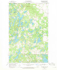
1968 · Lake Upsilon
USGS Topo · 1:24,000

1968 · Belcourt
USGS Topo · 1:24,000

1969 · Saint John
USGS Topo · 1:24,000

1969 · Rolla NE
USGS Topo · 1:24,000

1970 · Rolla
USGS Topo · 1:24,000