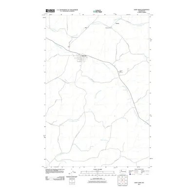
2011 Map of Saint John
USGS Topo · Published 2011About this map
Saint John serves as the central hub of this agricultural landscape in the Palouse region, where the street grid is anchored by Railroad Ave, W Front St, and S Jennings Ave. The town is surrounded by a complex network of seasonal and perennial watercourses, including the prominent Pleasant Valley Creek and Cottonwood Creek, which have carved distinct drainage patterns across the terrain. Small rural settlements like Juno and Huntley punctuate the northern reaches, connected by thoroughfares such as Juno Cutoff Rd and Texas Ferry Rd. Genealogists may find interest in the Pleasant Valley Cemetery, located southeast of the main townsite near the junction of several rural routes. The landscape is further defined by topographical features like Hastings Gulch and Larmie Field, reflecting the intersection of natural drainage and local land use in Whitman County.
Find a feature on this map
32 named features on this map. Tap any name to fly to it.
Don’t see what you’re looking for? This feature index may not catch every label — zoom into the map to look around manually.
Map Details
Editions of this 2011 Saint John Map
This is the sole edition of this map. No revisions or reprints were ever made.
Other maps of this area

1903 · Oakesdale
USGS Topo · 1:125,000

1905 · Oakesdale
USGS Topo · 1:125,000

1910 · Pullman
USGS Topo · 1:125,000

1950 · Endicott
USGS Topo · 1:62,500

1955 · Pullman
USGS Topo · 1:250,000

1955 · Spokane
USGS Topo · 1:250,000

1958 · Spokane
USGS Topo · 1:250,000

1958 · Pullman
USGS Topo · 1:250,000

1964 · Diamond
USGS Topo · 1:24,000

1964 · St. John
USGS Topo · 1:24,000