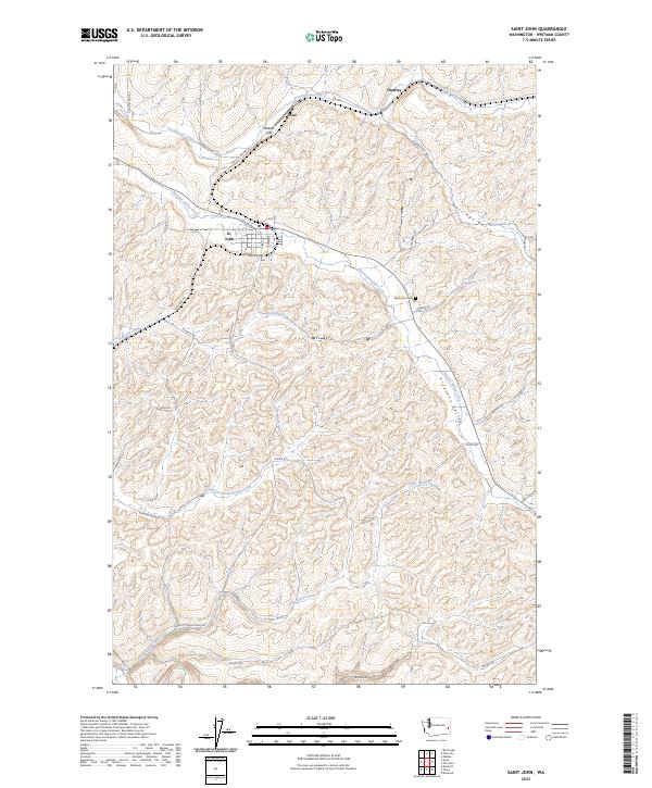
2023 Map of Saint John
USGS Topo · Published 2023About this map
The town of St. John serves as the central hub for this portion of the Palouse, situated at the intersection of S Main St and Railroad Ave. The surrounding landscape is defined by the complex drainages of Pleasant Valley Creek, Cottonwood Creek, and Little Valley Creek, which have carved intricate patterns into the plateau. Smaller settlements like Juno and Huntley appear to the north, connected by a network of rural routes such as Sunset Rd and Pine City-Malden Rd.
Find a feature on this map
39 named features on this map. Tap any name to fly to it.
Don’t see what you’re looking for? This feature index may not catch every label — zoom into the map to look around manually.
Map Details
Editions of this 2023 Saint John Map
This is the sole edition of this map. No revisions or reprints were ever made.
Other maps of this area

1903 · Oakesdale
USGS Topo · 1:125,000

1905 · Oakesdale
USGS Topo · 1:125,000

1910 · Pullman
USGS Topo · 1:125,000

1950 · Endicott
USGS Topo · 1:62,500

1955 · Pullman
USGS Topo · 1:250,000

1955 · Spokane
USGS Topo · 1:250,000

1958 · Spokane
USGS Topo · 1:250,000

1958 · Pullman
USGS Topo · 1:250,000

1964 · Diamond
USGS Topo · 1:24,000

1964 · St. John
USGS Topo · 1:24,000