
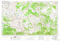
1954 Map of Saint Johns
USGS Topo · Published 1968About this map
Saint Johns and the surrounding high plateau of eastern Arizona and western New Mexico appear here as they were surveyed in the early 1950s. The landscape is defined by the Continental Divide winding through a region dominated by vast federal and tribal lands, including the Zuni Indian Reservation and Petrified Forest National Park. Settlement patterns follow water and transit corridors, from the agricultural pockets near Lyman Reservoir and Concho Lake to high-elevation communities like McNary and Greer within the Apache National Forest.
Find a feature on this map
68 named features on this map. Tap any name to fly to it.
Don’t see what you’re looking for? This feature index may not catch every label — zoom into the map to look around manually.
Map Details
Editions of this 1954 Saint Johns Map
3 editions found
Other maps of this area

1883 · Mt. Taylor
USGS Topo · 1:250,000

1883 · Tusayan
USGS Topo · 1:250,000

1886 · St Johns
USGS Topo · 1:250,000

1886 · Wingate
USGS Topo · 1:250,000

1886 · Mt. Taylor
USGS Topo · 1:250,000

1886 · Tusayan
USGS Topo · 1:250,000

1886 · Fort Defiance
USGS Topo · 1:250,000

1886 · Holbrook
USGS Topo · 1:250,000

1892 · Fort Defiance
USGS Topo · 1:250,000

1892 · St Johns
USGS Topo · 1:250,000