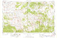
1958 Map of Saint Johns
USGS Topo · Published 1958About this map
The high plateaus and river basins of the Arizona-New Mexico border are meticulously documented in this 1958 survey, anchored by the settlement of Saint Johns and the winding course of the Little Colorado River. This map illustrates the vital water management systems of the era, including the Lyman Reservoir and Becker Lake, which supported ranching and agriculture in an arid landscape. To the north, the Zuni Indian Reservation and the colorful geologic formations of Petrified Forest National Monument contrast with the timbered heights of the Apache National Forest to the south. The passage of the Continental Divide through the eastern portion of the sheet marks the hydrological spine of the region, while isolated outposts like Atarque and Fence Lake reflect the sparse, rural settlement patterns of the late fifties. Major transportation corridors including U. S. 60 and U. S. 666 link these remote mountain communities and river valleys.
Find a feature on this map
55 named features on this map. Tap any name to fly to it.
Don’t see what you’re looking for? This feature index may not catch every label — zoom into the map to look around manually.
Map Details
Editions of this 1958 Saint Johns Map
2 editions found

Other maps of this area

1883 · Mt. Taylor
USGS Topo · 1:250,000

1883 · Tusayan
USGS Topo · 1:250,000

1886 · St Johns
USGS Topo · 1:250,000

1886 · Wingate
USGS Topo · 1:250,000

1886 · Mt. Taylor
USGS Topo · 1:250,000

1886 · Tusayan
USGS Topo · 1:250,000

1886 · Fort Defiance
USGS Topo · 1:250,000

1886 · Holbrook
USGS Topo · 1:250,000

1892 · Fort Defiance
USGS Topo · 1:250,000

1892 · St Johns
USGS Topo · 1:250,000